Maps
Within the GIStorical Antwerp project, countless maps were produced, both for UA researchers as for external academics. Below, a small sample of those maps is found
Sample of maps produced by GIStorical Antwerp
-
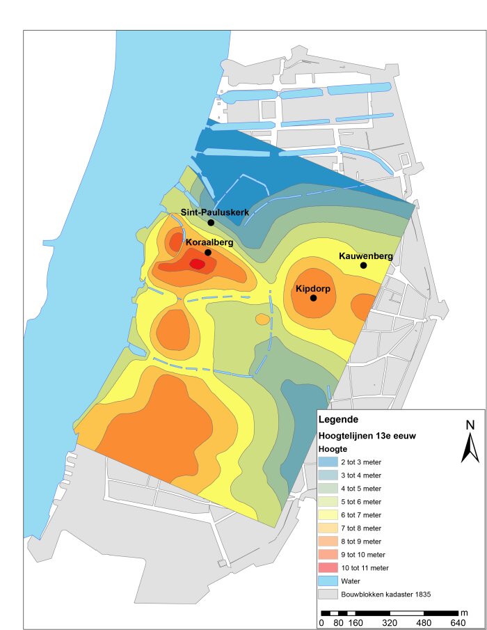 Topography
 -
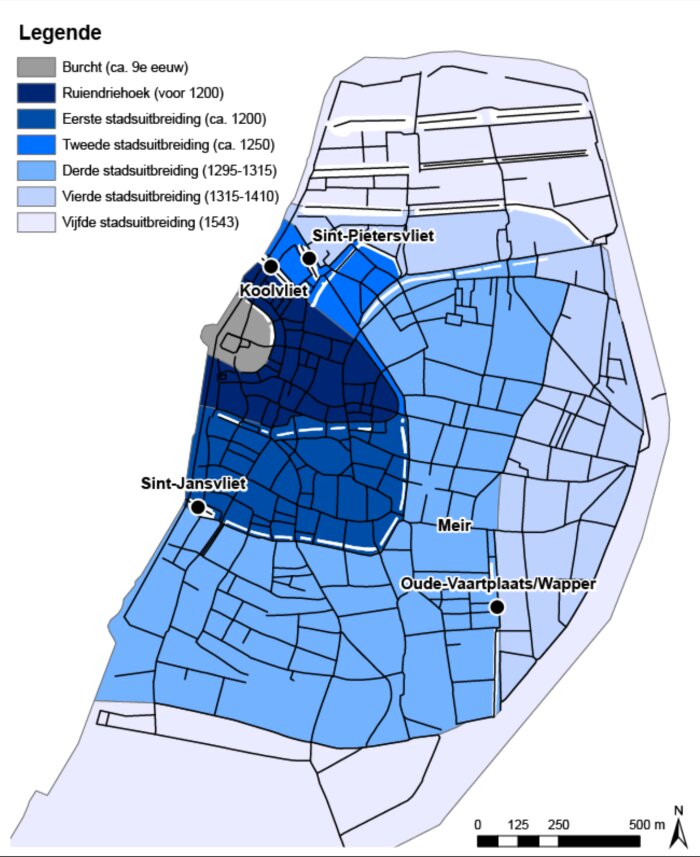 Development
 -
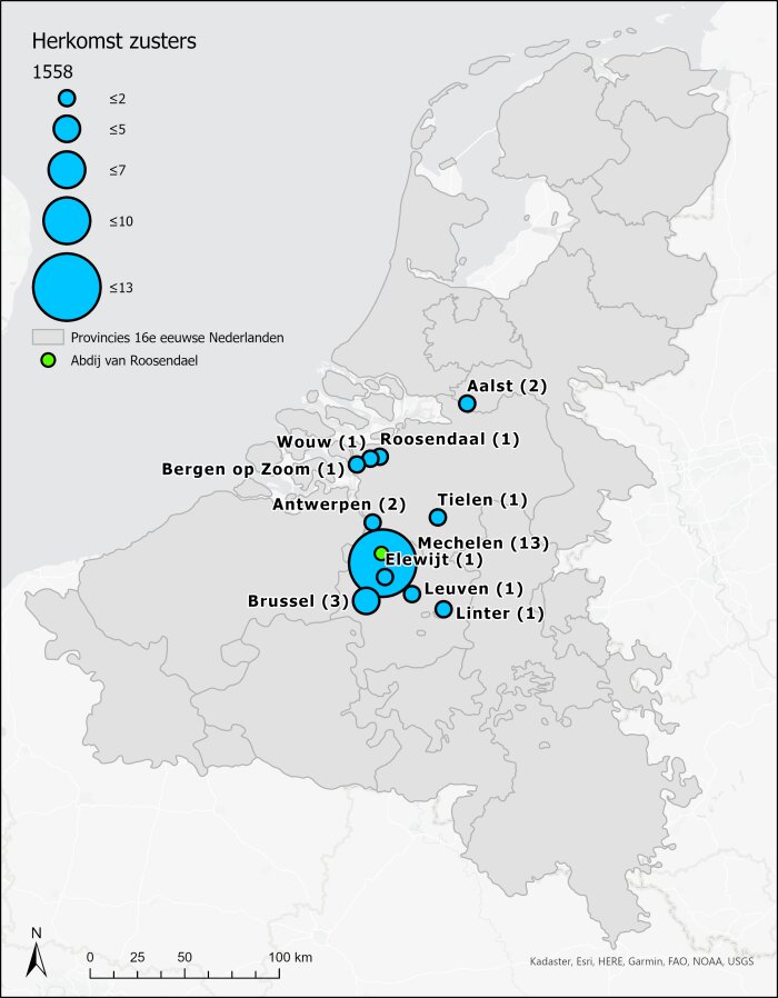 Sisters
 -
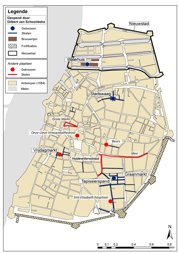 Van Schoonbeke
 -
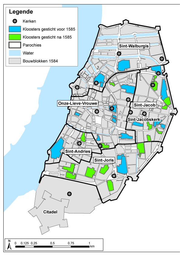 Cloisters
 -
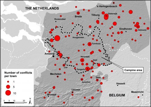 Conflicts Campine Area
 -
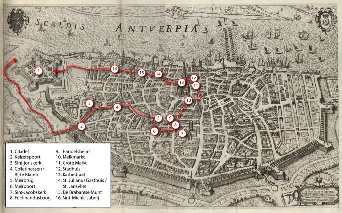 Maximilian
 -
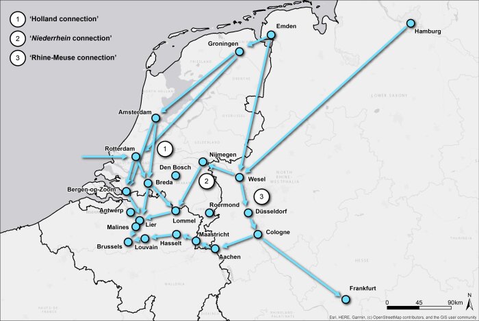 Smuggling
 -
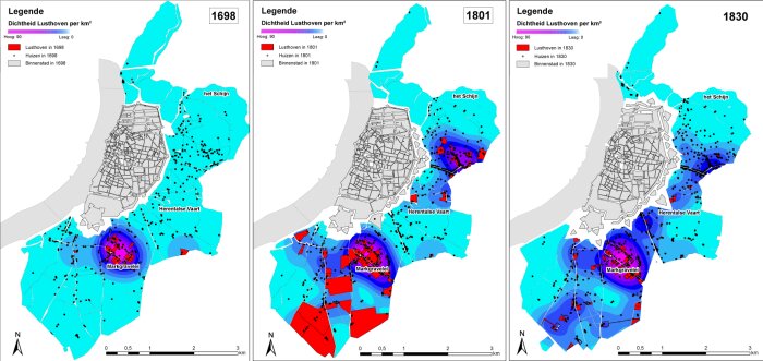 Elite housing
 -
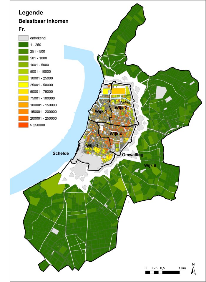 Taxation
 -
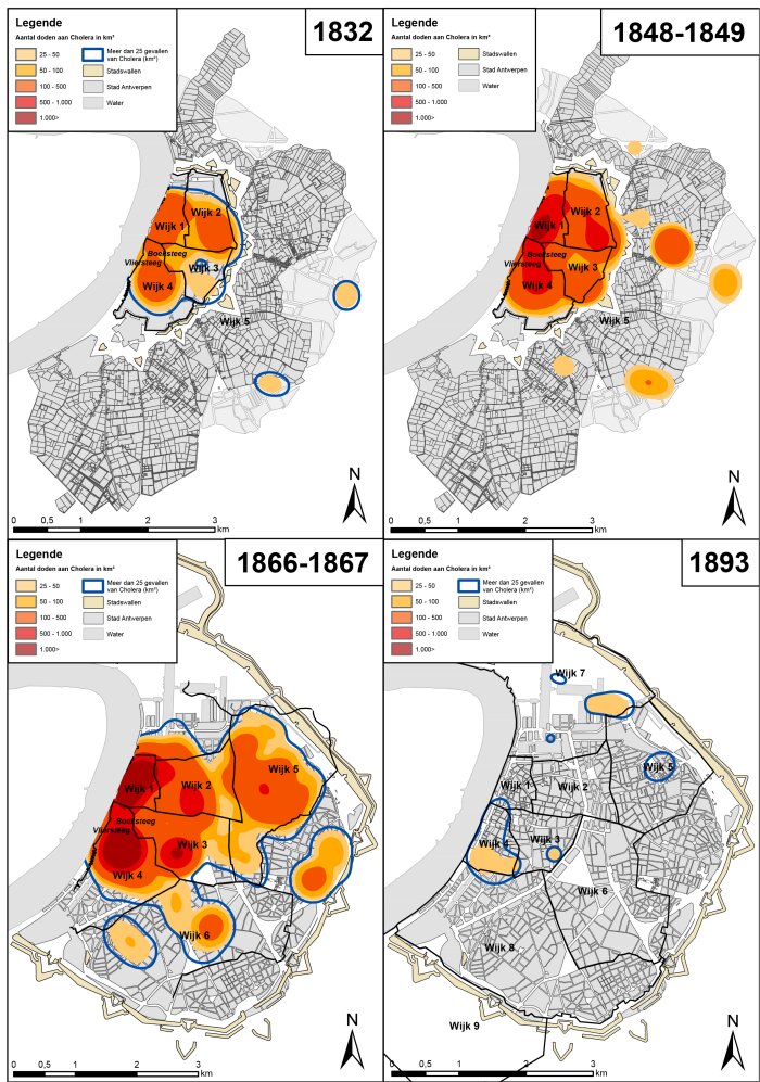 Cholera
 -
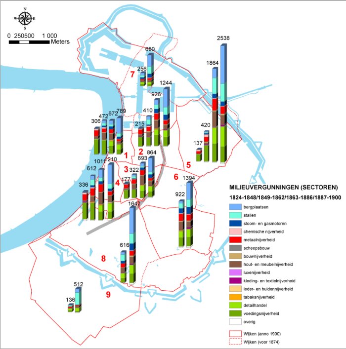 Environmental permits


