Layers and sources
GIStorical Antwerps used a variety of historical sources to contruct the seven snapshots. Some of these sources have been (partially) processed during previous research projects. Below you can find an overview of the layers and construction processes.
1584
In the 1980’s, Gilberte Degueldre (administrative assistant at the Antwerp City Archive, now Felix Archief) extracted information from different registers to set up a document with owners and tenants’ names, occupation and data concerning houses in Antwerp in 1584-1585: for wards 1 to 7 she used the Register inhouden[de] de huysen ende woonyngen bevonden inden I. II. III. IIII. V. VI. en[de] VII. wycken deser stadt van Antwerpe[n], 1584 and supplemented by the kohieren van de 5de of 100ste penning and the wijkboeken Ketgen; wards 8 to 13 were built up by using the kohieren van de 5de of 100ste penning only since the ‘Register’ for those wards has not been preserved.
Additional information was added from a.o. kohieren of the ‘Maandelijkse Quotisatie’ (wealth tax) and indications of the head of household’s faith from the ‘zuiveringsregister’ of the “Burgerwacht” en “Gewapende gilden”.
All this was combined by Gilberte Degueldre in Kadastrale ligger van Antwerpen (1584-1585) in a Word file, which then was turned into an Excel tab by Heidi Deneweth (VUB-FWO) and two job students, Joerie Lersberghe and Marlene Gonzalez, based on housing units (and no longer inhabitants).
Finally, Rogier van Kooten (UAntwerpen) and Iason Jongepier (UAntwerpen) have linearly referenced all the housing units in a GIS, thank to the connection they managed to do between the Gevelplan and the Wijkboeken (Ketgen).
Authorship : Gilberte Degueldre, Heidi Deneweth, Marlene Gonzalez, Iason Jongepier, Rogier van Kooten, Léa Hermenault, Marc Lathouwers and Joerie Lersberghe
*GIStorical Antwerp is especially gratefull towards: Gilberte Degueldre, Heidi Deneweth
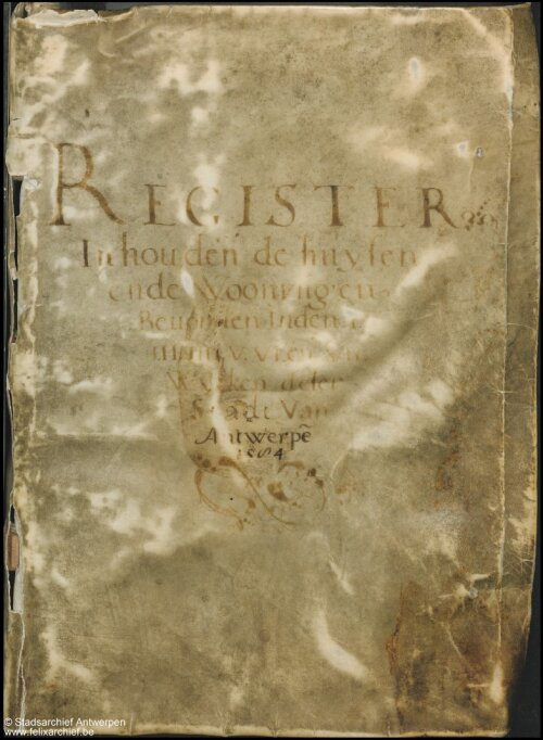
Register inhouden[de] de huysen ende woonyngen bevonden inden I. II. III. IIII. V. VI. en[de] VII. wycken deser stadt van Antwerpe[n]. 1584
1698
In 1695 it was decided to draw up neighborhood books for the area located close to the city wall of Antwerp (buitenijen). A page was provided for each property, but many property changes were eventually not recorded because there was considerable resistance to this initiative. That means that the wijkboeken of the urban fringe are less complete that are the wijkboeken for the inner city. The map of the properties has been drawn in 1691.Nowadays, these documents are stored in the Felix Archief, within the fonds of the Privilegekamer. To prepare the layer 1698, two documents have been used: maps and 'wijkboeken' (ward books).
Jobs Students under supervision of Rogier van Kooten and Iason Jongepier have extracted the information from the wijkboeken and the maps. In the database, each record corresponds to one plot.
Authorship : Iason Jongepier, Rogier van Kooten, Léa Hermenault
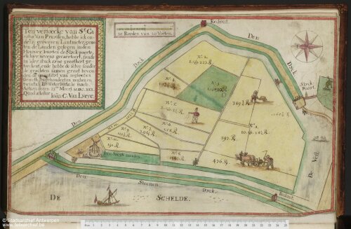
Felix Archief. inventarisnummer 1374#1.
1755
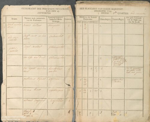
The 1755 census was ordered by empress Maria-Theresia: (...) une liste ou cahier pertinent de tous leurs habitants, hommes, femmes, filles, garcons et enfants. avec expression de leur qualité, condition, office, métier, trafic ou négoce, et des domestiques que’ils ont en leur service, ensemble des personnes qui seront logées, soit en chambre, (...) (Gachard, M and Verhaegen, P., eds., Recueil des ordonnances des Pays-Bas autrichiens, III, 1700-1794, 7, p408. An overview of the source criticism in: Blondé, B, Het Brabantse stedelijke netwerk (ca. 1750 - ca. 1790), Brussel, Koninklijke Vlaamse Academie van België voor Wetenschappen en Kunsten, 1999.
Since the census did not provide any fiscal information, an additional source from approx. the same period was used: Tax List of the civil guard (approx. 1750, FelixArchief GA4879)
This list was used for the yearly contribution to the civil guard. The amount of tax was based on the 20th penny (5%) of the house rent value and probably the facade width of the house. As far as we know, this tax list has not been used in published research so far.
Originals have been transcribed to an Acces Database by Bruno Blondé. This source was used and partly transcribed for his PhD research.
The databank was supplemented with lacking information from the original source and the civil guard tax list by job students (under supervision) in summer 2018. The tax list has been joined with the census information as good as possible. The tax list was probably not complete and not all heads of households in the census could be found in the list. In the end, we were able to match 4015 households in the census with the taxation. This resulted in an excel database of 16.069 records. 271 records mostly in the rural fringe, could not be localized and were therefore not included in the GIS layer. These records have been earmarked in the excel database in the field “IN_GIS” and value “FALSE”. The remaining 15.798 households were located in urban space using Linear Referencing.
A record provides all the information from the source per household. Households in the same building have the same house number which is unique within a street.
Authorship: Bruno Blondé
1796
Information contained in this layer comes from the Count of the Year IV in Antwerp. This document is stored in the Felix Archief (inventarisnummer: MA-BZA-D#1 to 5). It is a unique source. On the one hand one can in this source demographic data on the inhabitants of the city of Antwerp at the end of the eighteenth century (such as name, address, family relationship and family size, occupation), and on the other hand this source also contains information about the financial and social status of the Antwerp residents (number of service personnel, distinction between owners and tenants of houses, value and rental value of the home, number of use and / or luxury keys and horses, fortune status of the householder). The count of the year IV is therefore not just a census, but contains much broader information.
To know more about this layer, you can read :
- De Belder, J. (1974). Elementen van sociale identificatie van de Antwerpse bevolking op het einde van de XVIIIde eeuw : een kwantitatieve studie / door Jos De Belder.
- De Belder, J. (1977). De behuizing te Antwerpen op het einde van de XVIIIde eeuw. Belgisch Tijdschrift voor Nieuwste Geschiedenis, 367-446.
The original Access database transcriptions consisted of a separate database for each ward. In addition, there were two databases each for wards 1 and 4. All separate Access databases were merged into one database and checked for errors (double records removed). This database consists of three levels that are linked together: the first level contains information pertaining to individual houses. A house often contains one or more households. These have been stored in the second level. Information about members of a particular household can be found in the third level.
Reinout Klaarenbeek constructed the Gevelplan and Mutaties up to 1856 shapefiles, and prepared the databases of 1796 for the GIS-link.
GIS integration 1st – 4th Ward (innercity): Houses have been localized on the Gevelplan (inventarisnummer of the map: Felix Archief 12#4262-12#4265 ; table : the document “Percelenregister” is avaiblable at MA#2631 and its transcription at 100#3163) by Ric Janssens and Iason Jongepier in a GIS polygon layer.
GIS integration 5th Ward: Houses located within the 5th ward have also been linearly referenced based on the conversion of old and new houses numbers made by Ric Janssens for 1856.
Authorship: Ric Janssens, Iason Jongepier, Reinout Klaarenbeek, Rogier van Kooten and Léa Hermenault
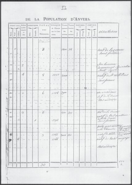
FelixArchief, MA-BZA-D#1
1835
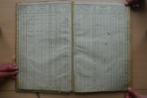
The information which has been used to create this layer comes from the cadaster. The document is currently kept in the “Archief van het Kadaster Antwerpen”. The registers which have been used are untitled “oorspronkelijke aanwijzende tafels (model 208)” (section 1-4 for the inner city, 5 for the urban fringe, and 6-7 for the area on the opposite river ban of the Scheldt). Please note that a copy of this document with other valuable information (house number) is also kept in the Felix Archief (section 1-4: inventarisnummer 174#661-174#664, section 5: inventarisnummer 174#583, and 6-7: inventarisnummer 174#602 - 174#614)
This document has been created between 1830 and 1834 by the city of Antwerp for taxation purposes.
If you want more information about this document, these references might be helpful:
- J. Verhelst, De documenten uit de ontstaansperiode van het moderne kadaster en van de grondbelasting, 1790-1835 (Brussel 1982) 48-49; J. Hannes, 'Het primitieve kadaster (vóór 1840) als bron voor de studie van de plattelandseconomie', Archief- en bibliotheekwezen in België 10 (1972) 193-201, 194.
- J. Hannes, 'Het primitieve kadaster (vóór 1840) als bron voor de studie van de plattelandseconomie', Archief- en bibliotheekwezen in België 10 (1972) 193-201, 194.
The original database was originally constructed by P. Vandermeersch (Centrum voor Cultuurgeschiedenis in Antwerpen) who studied the social typologies and hierarchies on the Antwerp real estate market. (P. Vandermeersch, B. Blondé en R. Marynissen, “Typologie sociale du parc de logements à Anvers basée sur le cadastre de 1834” in: R. Baetens en B. Blondé, (ed.), Nouvelles approches concernant la culture de l’habitat. Colloque International, Université d’Anvers, 24-25.10.1989, Turnhout, 1991, p. 49-67.
The database was enhanced and extended by:
- Hilde Greefs: (consolidation of unique owners, first categorization of professions)
- GIStorical team: (rural fringe)
- Elois Vincendet under supervision of the GIStorical team: other side of the river Scheldt, (“linkeroever”)
An additional professional categorization, comparable to the other GIStorical layers, was also added by the GIStorical team.
The combination of three different sources in three different databases (city center, rural fringe and other side of the Scheldt) meant that not all fields in the database could be filled consequently.
Authorship: Hilde Greefs, Ric Janssens, Iason Jongepier, Léa Hermenault and Marc Lathouwers
1898
The information which has been used to create this layer comes from the Adresboek van de stad en de provincie Antwerpen, Ratinckx, 1898.
One copy is nowadays kept in the Felix Archief (inventarisnummer BIB-AB#26). It has been created to give information about addresses and commercial activities in the city, and edited by the Ratinckx brothers.
If you want to know more about this document, you can read:
- P. Van den Eeckhout, D. Luyten, G. Devos and C. Vancoppenolle (2005) ‘De ondernemingen’, in P. Van den Eeckhout and G. Vanthemsche eds., Bronnen voor de studie van het hedendaags België, 19de-20ste eeuw, (Brussel, vierde druk), 2de deel, 775-776.
- A. Warzee (1952) Recherches bibliographiques sur les almanachs belges (Brussel); and G. Zech-Dubiez (1902-1904) Les almanach belges. Etude bibliographique (Braine-le-Comte).
- R. Gobyn (1983) ‘De “Almanach” en de “Annuaire du commerce et de l’industrie de Belgique”. Hun betekenis voor het sociaal-economisch onderzoek van het platteland en de kleine steden in de tweede helft van de negentiende eeuw. Het geval Tielt’, Tijdschrift voor Sociale Geschiedenis, 29, 49-59.
The extraction of information has been made in India ( by the “Hi-Tech Outsourcing Services company”), in the context of a small-funded project lead by Ilja Van Damme to research the shopping landscape of Antwerp in comparison with Brussels. One record represents one house number.
The information of the Adressbook has been localized with points. For the innercity, the addresses have been mapped (that means that points have been draw) using the Gervais map. For the rest of the addresses, points have been linearly referenced (automatically and/or manually) using the information given in the document (in most of the case, crossroads of streets are mentionned) and the Hypsos map on which we can read some numbers of houses.
Authorship: Ilja van Damme, Ric Janssens, Iason Jongepier, Reinout Klaarenbeek, Rogier van Kooten and Léa Hermenault
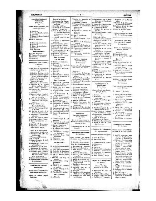
Adresboek van de stad en de provincie Antwerpen, Ratinckx, 1898, p.4
1984
The information which has been used to create this layer comes from the ‘Planologische Databank Antwerpen (PDB 1984)’ and the ‘Atlas Kansarmoede 1987-1988’
PDB is a GIS at parcel level, established by UAntwerpen and commissioned by the Spatial Planning Service of the City of Antwerp after its merge with 7 adjacent districts in 1983. The database contains detailed information on land use, public domain equipment, building characteristics and demography of more than 120.000 parcels, grouped in approximately 300 statistical zones, 3000 building blocks and 13.000 street side segments. Exhaustive field work was organised for the registration of the factual land use and public, commercial and other private activities in buildings as visible from the street. Population data were added at address level afterwards.
A project on the unequal distribution of the quality of the housing environment in the city and the socio-spatial differentiation of vulnerable groups was launched short after, commissioned by the King Baudouin Foundation and the Regionaal Instituut voor Samenlevingsopbouw RISO (Atlas Kansarmoede). Several public and local welfare organizations cooperated by providing additional datasets on socio-economic vulnerability and social welfare.
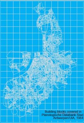
The database is stored in the archives of the faculty of Social Sciences and joined GIStorical in 2020. Both manuscripts that were edited under the auspices of the Koning Boudewijnstichting (1987 and 1988) are available in the UAntwerpen library. It has been created for science-policy nexus for spatial and welfare planning. The original database was created by University of Antwerp as commissioned by and in cooperation with the City of Antwerp, Koning Boudewijnstichting and RISO.
If you want to know more about this document, you can read:
Marynissen, R., Poppe E., Van Hove E. (1987) Kanarmoede in de grootstad Antwerpen, deel 1, De kwaliteit van het wonen, KBSStichting: 93.
Marynissen, R., Poppe E., Jacobs T, Van Hove E. (1988) Kanarmoede in de grootstad Antwerpen, deel 2, De bewoners, KBSStichting: 153.
Loots, I., Van Hove, E., (1988) De planologische databank Antwerpen, Planologisch nieuws, 8(2): 109-111.
Van Hove, E., Marynissen, R., Poppe E. (1988) Een atlas van de kansarmoede in Antwerpen, Planologisch nieuws, 8(3): 162-166.
Not the complete database has been connected to the map. Only fields concerning the spatial location (addresses) and the type and function of buildings. These functions could be related to professional groups. Other information, such as household characteristics and names could not be included because of privacy concerns.
The information from the PDB and the Atlas Kansarmoede has been localized with points. These points, representing the households, have been linearly referenced (automatically and/or manually) using the information given in the document.
Authorship: Iason Jongepier, Léa Hermenault, Rogier van Kooten, Marc Lathouwers, Ilse Loots and Koen Pepermans,